Making good use of the long independence day weekend, Stefan and I had decided to hike
White Mountain Peak (Wikipedia), the easiest fourteener in California. It's easy because the elevation gain is modest (around 3k ft) and there is a gravel road leading all the way to the top. I had fond memories of hiking Mt. Princeton in my student days in Colorado, but not hiked a fourteener since, and Stefan had no experience with this altitude either; therefore our choice was appropriate.
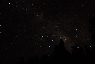
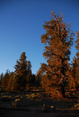
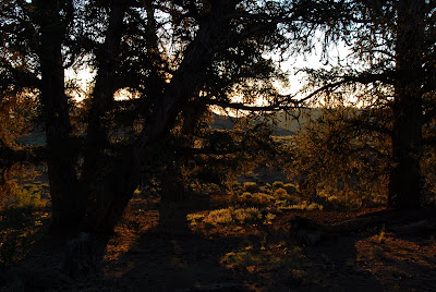
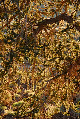
Since we live at sea level, we did a warmup hike starting at Yosemite's Tuolumne Meadows the day before, and spent the night at high altitude near the gravel road leading to White Mountain Peak. This was the first time I slept outside, our spot had bristlecone pines, and the night sky was perfect.
Our breakfast featured three kinds of bread, salami, my favorite French cheese, Nutella, and more stuff I forget, unquestionably offsetting the lack of running water. The bristlecone pines looked great in the morning sun.

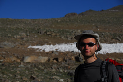
We parked the car at the trailhead at the locked gate 2 miles before Barcroft Station, and started the hike. Hiking this part of the trail would be trivial at sea level (it's gravel but I think it's good enough you could rollerblade it if you're crazy); but here, its gentle upward slope is a good way to adjust breathing, walking, and talking to the high altitude. Taking pictures is always a good way to catch some breath.
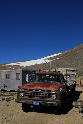
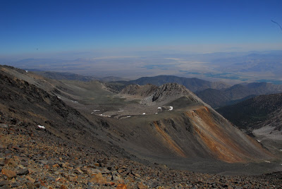
 Barcroft Station
, which we reached after the first 2 miles, reminded me of the town of Ward in Colorado - but it's probably cozy inside. However I'm still wondering how the sheep farm fits into their mission which I thought was about weather and astronomy. Hmm.
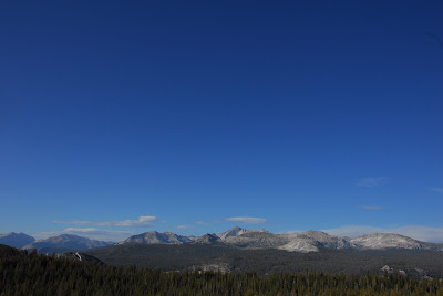
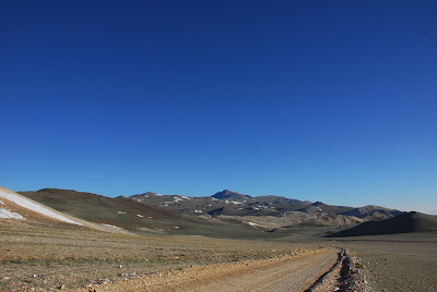
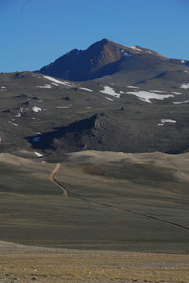
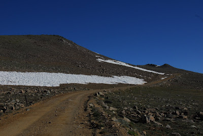
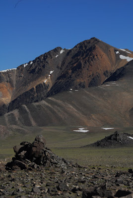
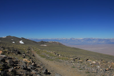
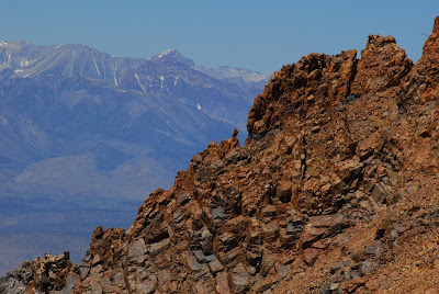
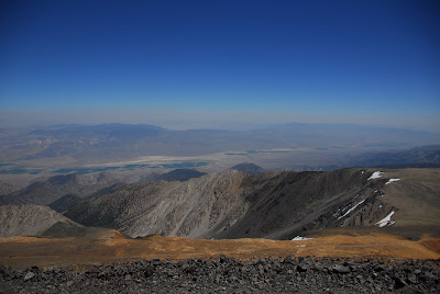
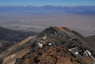
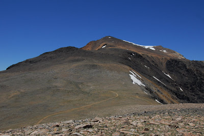
After Barcroft station, the trail continues about three more miles north toward the mountain. On our left (west), we had sweeping views of the Sierra Nevada peaks, which are lined up behind a deep valley; on our right we saw the White Mountains and somewhere in the morning haze Death Valley Natl. Park (south east); in front of us (north) was White Mountain Peak. While the trail has some ups and downs and gentle turns to traverse around minor peaks and piles of rock, it is uneventful, leaving the stage open for the vast landscape.
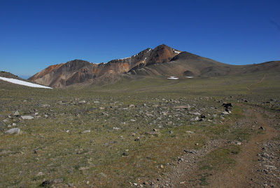
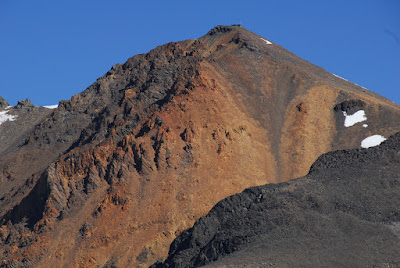
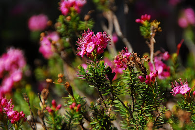
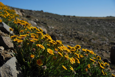
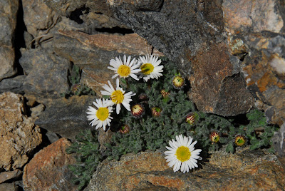
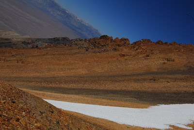
The ascent to the top of the actual mountain starts after a noticeable drop, and it's switchbacks all the way to the top. The rocks that I saw on white mountain have two colors: most of them are some are dark grey, almost black, but in between there are also brown rocks; I think this color is a mix of brown, orange, and gold. I enjoyed the contrast between these colors and the Sierra mountains in the background. We saw some little flowers that looked a bit like daisies to me, growing on this big mountain.
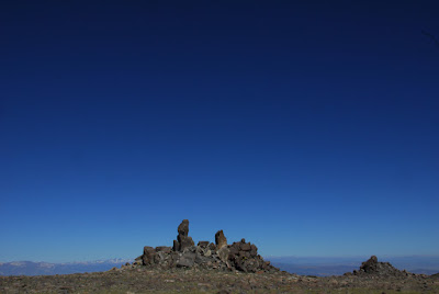
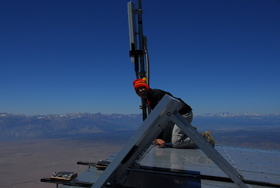
We reached the summit a bit before noon - clear sky, sunshine, and not too cold or windy. We had lunch sitting on the door steps of the
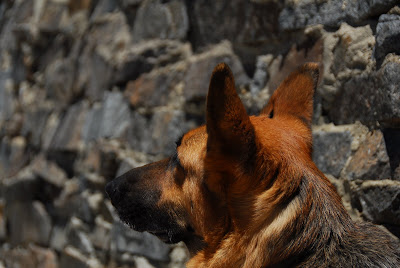
Summit Lab. A well-behaved dog had also made the hike. Eventually I wanted to have a 360 degrees view, so I climbed onto the roof of the station and took a few pictures from there.
After an hour or so after we had made it to the summit, I noticed that my buddy was gone; he had started descending to cure a mild headache. I thought I should try my best to catch up and also went down the mountain; but this time straight down over the rock fields instead of the winding trail. Down from the peak, there was the first uphill section again. I thought that he might be waiting there, but started getting worried that he might still be at the summit or somewhere behind me - unfortunately I hadn't looked around carefully enough, and on my quick descent there was more than one stretch were I couldn't see the trail. After climbing up this little uphill section, waiting a bit and using the tele zoom of my camera to enhance my vision, I still could not find him. Now I made a calculation: With high likelihood he was just faster than me, so in that case I'd just need to follow him to the car. However, I thought there was also a chance that he was behind me, possibly looking around for me, and getting worried about me disappearing. I consulted with some other hikers who had come down the mountain behind me and concluded that the safest option was to go back up to the summit and then just hike back the trail, because this way I could make sure that neither of us would need to wait for the other a potentially unlimited amount of time. The cost of this option was to add another summit roundtrip to my delay. Besides, it was a great workout. I had enough water and food with me (Goji Berries and dark chocolate), the weather was perfect and it was only 2pm at that point.
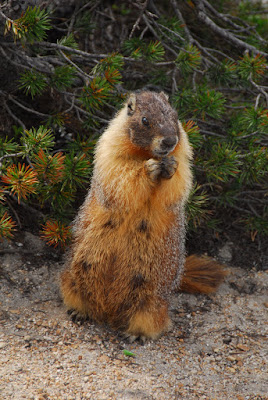
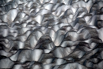
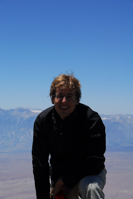
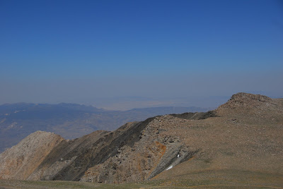
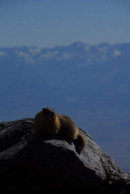
I was back at the summit for the second time at 3:25 pm. I took few pictures at that point to avoid additional delays; the one summit picture I took looks toward the south, and explains why this mountain range is called the "White Mountains": It has a few peaks that are white. I also sent Stefan an SMS and a voice mail about where I was; but this was a bit pointless because the cellphone coverage is limited to the actual summit. On my way back, I saw two marmots, plus I noticed quite physically that there are two uphill stretches as you hike from the mountain to the parking lot: first a short, steep section, and then a more gradual uphill stretch just before Barcroft station.

Stefan and I met at Barcroft station and hiked the last 2 miles together. This was nice since I was getting tired at that point, and having someone to chat with makes a big difference. On my next hike I will bring walky talkies, and communicate my intentions clearly. Plus, in a similar situation I'll look around thoroughly before descending and stay on the trail as opposed to trying to catch up with shortcuts over rocks.
White Mountain Peak rocks, I really enjoyed this hike, and I'm wondering which fourteener should be next.
Update: The fourteener I hiked in my student days was Mt. Princeton, not Mt. Democrat as originally written.